DKIslandBogo
Low farming island with one village, an eastern forest, a causeway and a bridge, and wide open fields. Plan operations on this 7.2 km Arma Reforger map in TacOps.
Map tiles updated
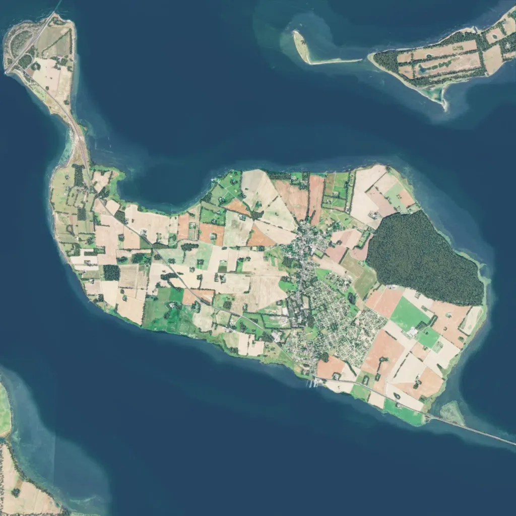
A 7.2 km map of a low farming island in open sea, with contours reaching 30 m. Patchwork fields cover most land, with a dense forest block in the east. A village lies in the centre-east, though only 36 buildings are mapped. A main road runs from a northwest causeway to a southeast bridge; roads total 22 km. Open fields give little cover outside the village and forest. The author calls it a work in progress of the Danish island of Bogø. Suits small infantry and light vehicle operations.