Artillery Village Assault
Small farmland map around one central village, with forest to the west and wide open fields. Plan operations on this 2.6 km Arma Reforger map in TacOps.
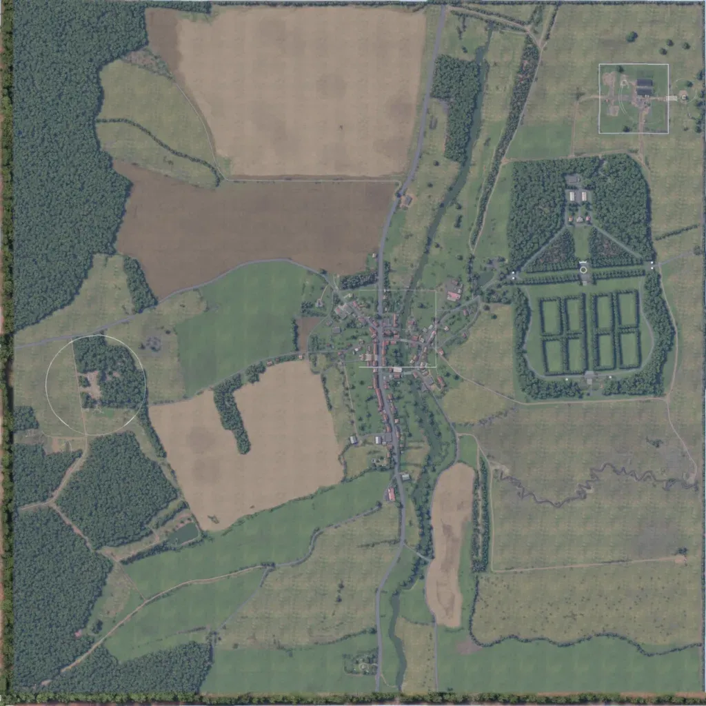
A 2.6 km square of gently rolling farmland (320–380 m), with dense forest along the west edge and bare ploughed fields north and southwest. One village sits at the centre on a north–south road beside a wooded stream. East of it lies a hedge-enclosed compound of gridded plots, with a small building cluster in the northeast. Roads total about 22.8 km; there are no lakes, only a creek winding across the southeast. The author says it recreates Romagne-sous-Montfaucon, France. Open fields suit a compact assault on the village.
