Gairezi River Valley
Rolling bush and grassland split by a winding river, with farms, two airstrips and scattered villages. Plan operations on this 10.2 km Arma Reforger map in TacOps.
Map tiles updated
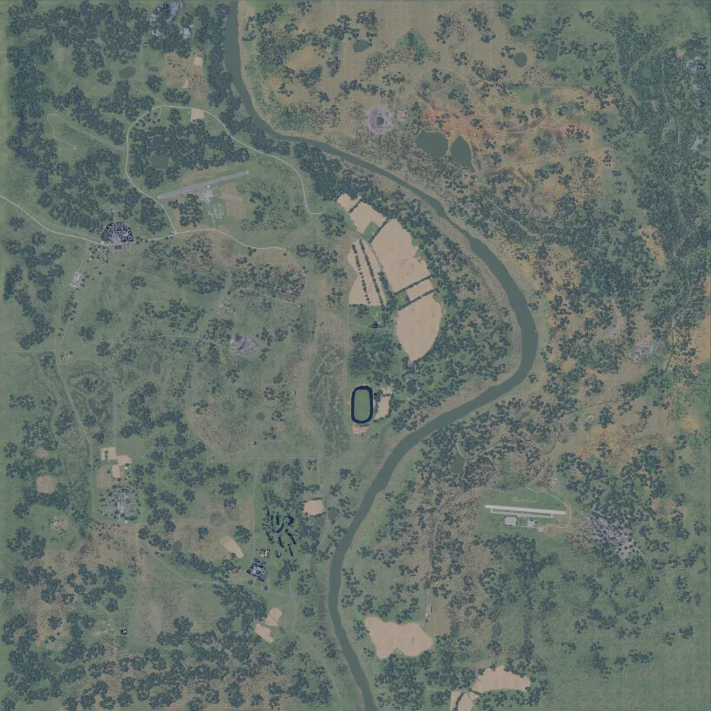
A 10 km square of rolling bush and grassland, 10–210 m high, split north to south by a winding river. The author presents the river as the border between Rhodesia and Mozambique. Large farm fields lie west of the river, with a village and airstrip in the northwest and a town beside a second airstrip in the southeast. About 146 km of roads, mostly thin tracks, connect them. No imagery gaps or placeholder ground are visible. It suits patrols, river crossings and airfield raids. The author notes the Malvian Bushwar Props Pack is needed to display it correctly.
Map facts
- Game: Arma Reforger
- Size: 10.2 km, 11 by 11 grid squares of 1 km
- Made by screamingemu (Workshop page)
Layers and modes
- Satellite imagery
- In-game map
- Roads
- Contour lines every 10 m
- Named places
- Hillshade
- Slope analysis
- Tree canopy
- Line-of-sight checks
- Water levels
- 3D terrain view (TacOps Pro)