Operation Raging Tigris
Desert river map: a central island and two banks linked by bridges, with an airstrip in the northwest. Plan operations on this 2.6 km Arma Reforger map in TacOps.
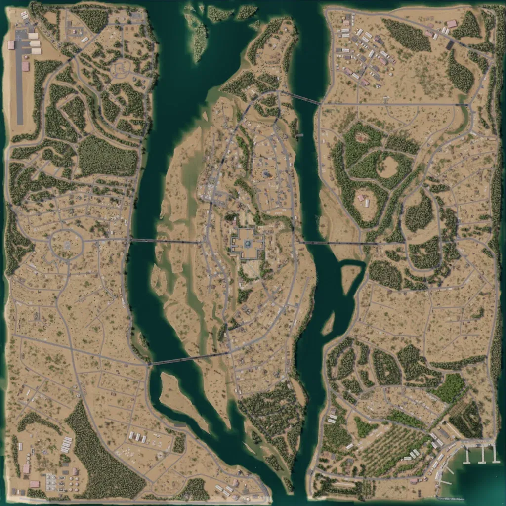
Desert map about 2.6 km across, split north to south by a wide river into a west bank, a central island and an east bank. Bridges link the island to both banks; 121 km of roads and 5,083 buildings, densest on the central island. Landmarks include a northwest airstrip, a southwest tank farm and a walled central compound. Forest patches break up the sand, and imagery covers the whole map with no placeholder ground. Suits urban fighting and river crossings. The author lists it as a work in progress.
