Polish Belarus Border
6 km forest and farmland border area split by a winding north-south river, with a paved checkpoint at the centre. Plan operations on this 6.1 km Arma Reforger map in TacOps.
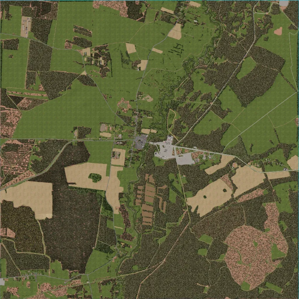
The author sets it near Bobrowniki on the Poland–Belarus border. A narrow, winding river runs south to north through the middle. A paved checkpoint complex sits at the centre on an east-west road crossing the river. Dense forest covers the south and much of the east; open grass fields dominate the northwest. About 305 buildings form small hamlets and farm clusters along the roads. Wide grass fields offer little cover; a large cleared patch lies southeast. It suits infantry and light vehicle fights over the crossing and forest routes.
