Road to Konstantynivka
10 km farmland map with large open fields, a forest-lined river, small villages and long straight roads. Plan operations on this 10.2 km Arma Reforger map in TacOps.
Map tiles updated
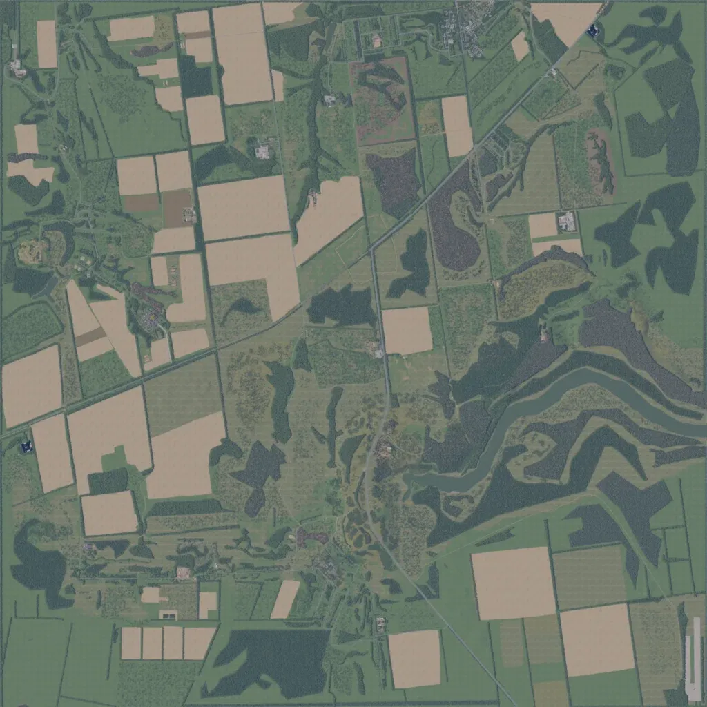
This 10 km map is mostly low farmland between 0 and 70 m elevation. Large bare fields fill the northwest and southeast, split by tree lines and pasture. A river winds in from the east edge toward the centre, lined with dense forest. A main road runs diagonally from the northeast corner to the west edge; another heads south through the centre. Small villages sit in the north, west and southwest. It suits mechanized operations over open ground, with forest and river cover for infantry.
Map facts
- Game: Arma Reforger
- Size: 10.2 km, 11 by 11 grid squares of 1 km
- Made by UA Olympiec (Workshop page)
Layers and modes
- Satellite imagery
- In-game map
- Topographic map details
- Roads
- Contour lines every 10 m
- Named places
- Hillshade
- Slope analysis
- Tree canopy
- Line-of-sight checks
- Water levels
- 3D terrain view (TacOps Pro)