Ronu Sala
Low forested island with open western grassland, one central village, a southeast airstrip and a small pier. Plan operations on this 6.1 km Arma Reforger map in TacOps.
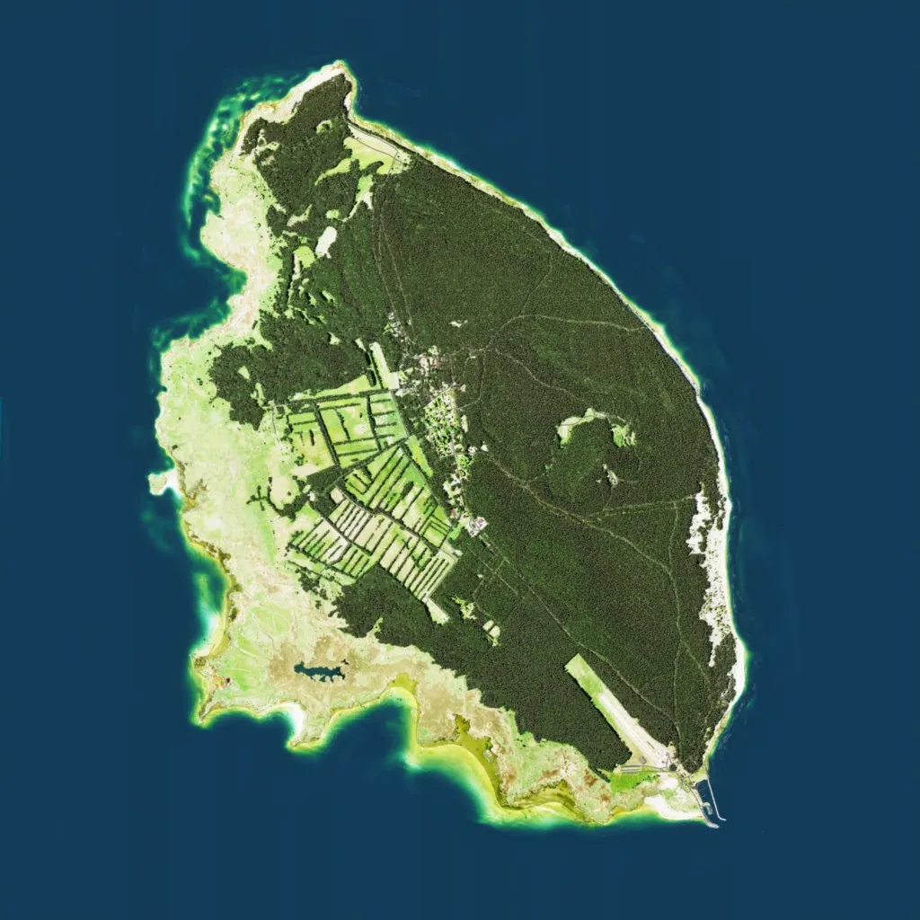
The author says it recreates Ruhnu in the Baltic Sea. The low island, contoured from 10 to 30 m, sits in a 6 km world. Dense forest cut by dirt tracks covers the north and east; the west and southwest are open grass. One village lies in the centre beside strip fields, with 148 buildings mapped. An airstrip runs along the southeast to a small pier; a small lake lies southwest. No imagery gaps or placeholder ground are visible. It suits small infantry, patrol and coastal landing operations.
