The Apertu Islands
Forested 8 km archipelago with two airfields, a central bay, and road links between the islands. Plan operations on this 8.2 km Arma Reforger map in TacOps.
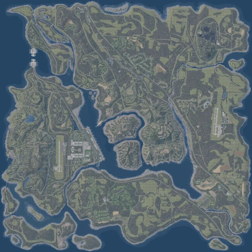
The 8 km square map is a forested archipelago of rolling hills up to 250 m, with 35 lakes. A large central bay holding small wooded islands splits the land, and narrow straits separate smaller islands in the southwest. Airfields sit on the bay's west shore beside a large base, and in the east. 4,469 buildings and 319 km of roads, including a long northwest-southeast highway, serve villages, farms, and industrial sites. No imagery gaps or placeholder ground are visible. It suits combined-arms fights over crossings, airfields, and high ground.
